Gallery 9
|
||||
MAPS OF TRAPPE & THE EASTERN
SHORE
|
||||
Where do you want to go next?• = recent addition• = multiple images |
||||
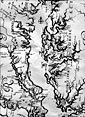
 901. Map of the Chesapeake Bay by Capt. John Smith from surveys done in 1606 |
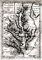
 902. Map of Virginia and the Chesapeake Bay, 1633 |
 903. A detail of the Chesapeake Bay As Is Planted and Inhabited this present Year 1670 |
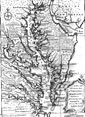
 904. Nova Terra-Maria Tabula (New Map of Maryland) by John Ogilby, 1671 |
 905. Thornton and Fisher's copy of a chart by Anthony Smith, 1689. |
 906. A.H. Jaillot's Detailed Map of Va., Md., Pa., and East & West NJ. published in Amsterdam in 1700. |
 907. Herman Moll's excellent map of Virginia and Maryland, 1720 |
 908. A New and Accurate Map of Virginia & Maryland, 1752 |
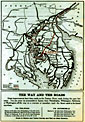
 909. Carte de la Baiae de Chesapeake et de la Partie Navigible des Rivieres.... 1778 |
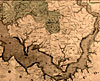
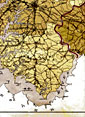
 910. Talbot Co. & other areas from Dennis Griffith's Map of the State of Maryland, published in 1795 |
 911. J. H. Alexander's map of Maryland, 1835, Trappe area detail. |
 912. Map by Mitchell done in 1846 shows three places on the Eastern Shore named Trap |
 913. 1858 map of Trappe & Talbot Co., Md. by William Dilworth |
 914. Chesapeake Bay Chart No. 32, Magothy River to Choptank River, 1862 |
 915. Detail of Trappe District from Simon J. Martenet's Map, 1866 |
 916. A platt showing Isle of Rays and the Barnett farms, 1867. |
 917. 1877 Grey Map of Trappe |
 918. Trappe District map from the Illustrated Atlas of Talbot and Dorchester Counties, 1877 |
 919. An interesting platt from May 10, 1880 "Map of Lands belonging to Dickinson Heirs" |
 920. Trappe area from J. L. Smith's 1891 Map of the Eastern Shore |
 921. Trappe District as shown on the J.L. Smith & Co. map of Talbot Co.from 1898. |
 922. Trippe & Hambleton real estate and insurance advertising map circa 1900 |
 923. Nevius & Frampton's hardware store map showing approaches to Talbot County c.1910-1919 |
 924. Detail from a 1912 USGS topographic map of the Trappe area. |
 925. A detail from a Rand McNally map circa 1920, showing Kirby's Wharf. |
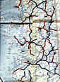 926. Detail from "Map of Maryland Showing State Road System" 1925 |
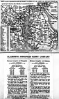 927. Claiborne-Annapolis Ferry, 1932 |
 928. Detail from a 1940 State of Maryland road map made after the 1935 |
 929. Route 213 Trappe by-pass built in 1940 |
 930. General Highway Map of Talbot County with revisions to 1953 |
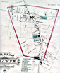
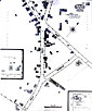 931. Trappe, Md. from the 1891 Sanborn Insurance Co. map |
||||

The artifacts and the images of the artifacts displayed here are NOT FOR SALE and unless credited otherwise, are the property of James Dawson or the Unicorn Bookshop Inc. and are used with all rights reserved. None of the images displayed here may be reproduced in any manner without written consent of the owner.

Trappe Artifacts Gallery 9. MAPS OF TRAPPE & THE EASTERN SHORE