| |
|
Please scroll right to view entire image
→ → → |
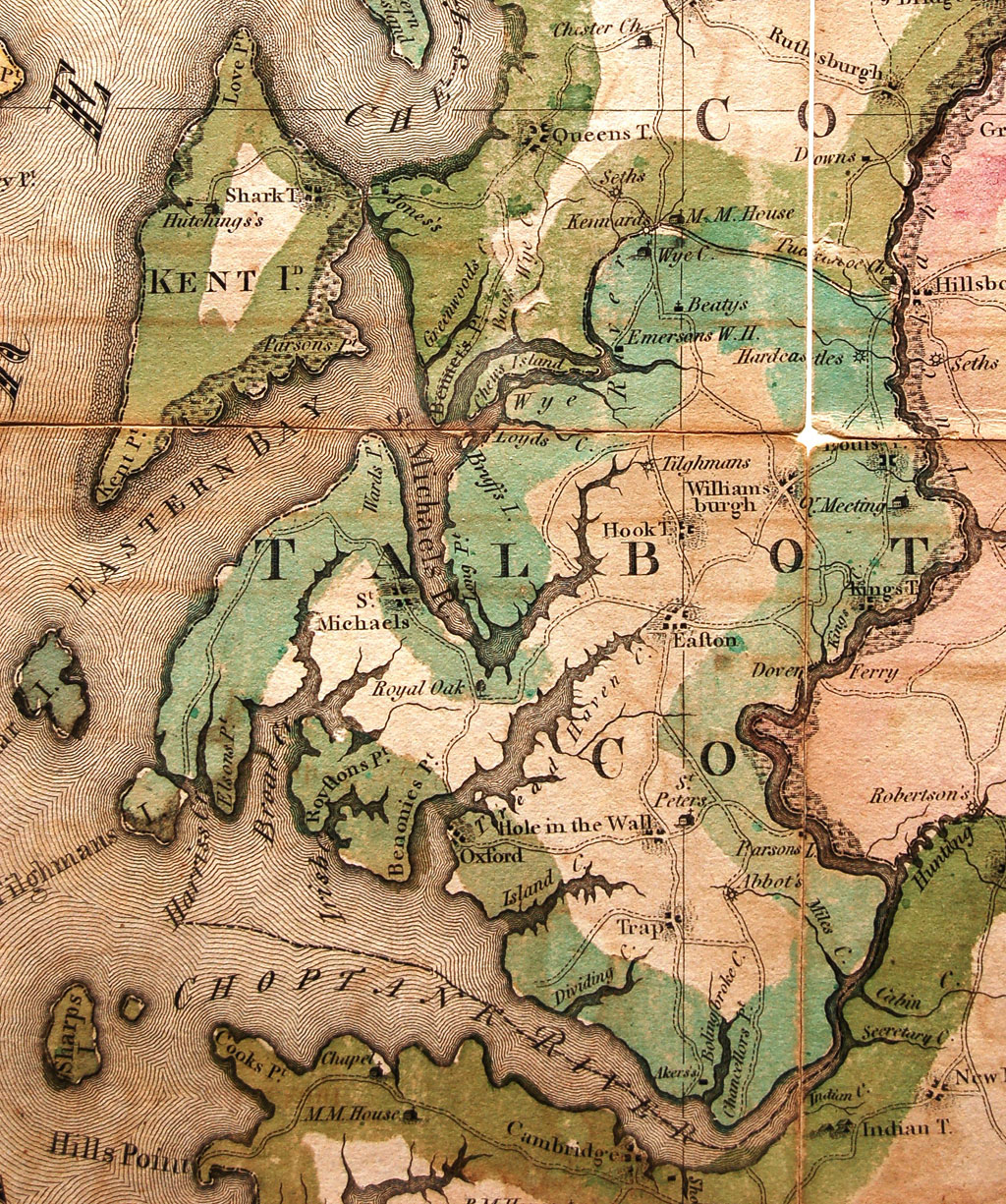
This is a
close-up of Talbot Co. from Dennis Griffith's
"Map of the State of Maryland"
published in Philadelphia in 1795. This is a very
detailed map of the state locating mills, iron
furnaces, forges, Houses of Worship, taverns and
warehouses. This is the first map to show Trap as
it was spelled then. It also locates Aker's
ferry to Cambridge (near the site of the Choptank
Bridge), Abbot's Mill (later Wright's
Mill), and St. Peter's Church which we know
as Old White Marsh Church.
The map
measures 29 x 50 inches and has been called one
of the best maps printed the early U.S..
Unfortunately, because of it's size, it was
so expensive that only a few copies were sold.
And if that wasn't bad enough, the
information was "borrowed" by other
cartographers who published the map in smaller,
cheaper versions, with the end result that poor
Griffith went bankrupt.
Originals
are very scarce. This one is used courtesy the
Maryland Room of the Talbot Co. Free
Library. Photographs by Robert
Horvath. |

Map Title
|

Chesapeake
area
|

Dorchester
area
|
Please use
your
browser's "Back" Button
to return to this page.
|
|