 | |||
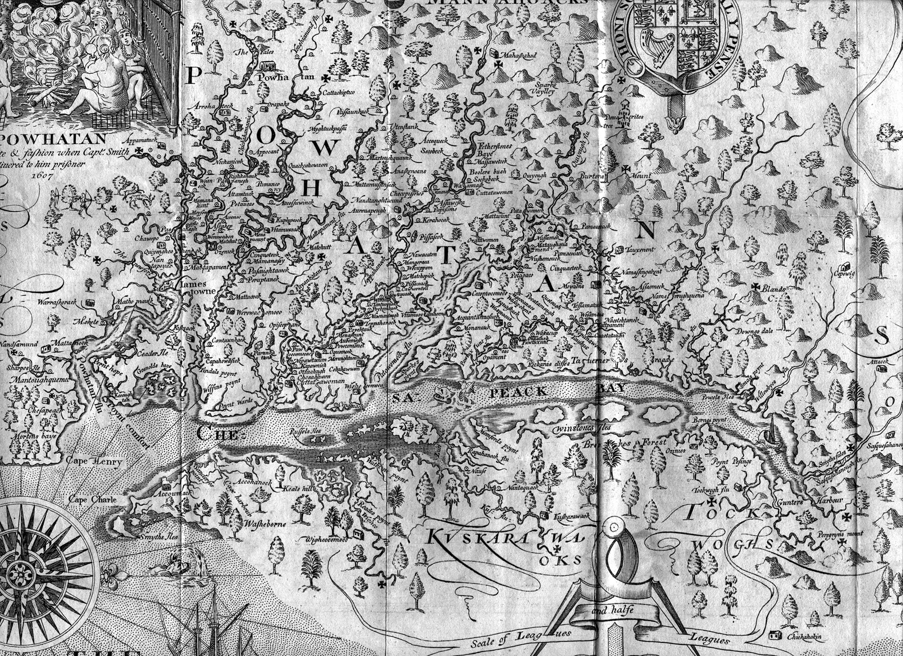
The first detailed map of the Bay was made by Capt. John Smith from surveys done in 1606. It is surprisingly accurate, however Smith sailed past most of the Eastern Shore and never saw the Choptank River. It is not on his map. He mapped three islands he named the Winstones isles, perhaps the lower one is Dorchester Co. the center one Sharps island and the upper one Kent Island. The interior of the Eastern Shore was called Brookes forest. This is correct as the Trappe area was once heavily forested. The trees shown are probably accurate as to species. The Choptank River made its first appearance on Augustin Herrman's 1670/73 map of "Virginia and Maryland" as "Chaptanck". The map was first printed in 1612 and several times in the 1620s. Originals are quite valuable. It has since been reprinted many times, usually in poor quality reproductions. This is a detail from an excellent facsimile done in 1812. It was printed from a copperplate, just like the original. Note the sea serpent. Perhaps it is Chessie. |